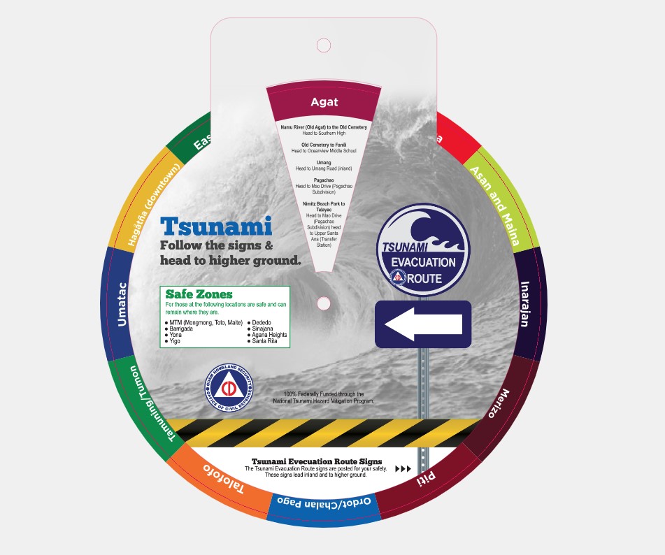
TSUNAMI EVACUATION WHEEL
for Guam

Position Paper on Tsunamis and Climate Change
Response to Tsunamis in Agat Marina
Response to Tsunamis in Apra Harbor-ftkt
Response to Tsunamis in Tumon & Agana Bays
Progress Report 3 - Agat Marina
Tsunami Inundation Modeling & Mapping for Guam Southern Shores: Umatac, Merizo, Inarajan, and Talofofo
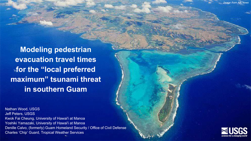
Modeling pedestrian evacuation travel times for the “local preferred maximum” tsunami threat in southern Guam
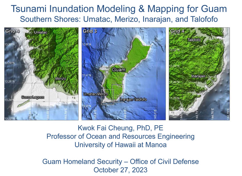
Tsunami Inundation Modeling & Mapping for Guam Southern Shores: Umatac, Merizo, Inarajan, and Talofofo
Modeling pedestrian evacuation travel times for the “local preferred maximum” tsunami threat in southern Guam
What are Tsunamis and What causes them?
Tsunamis (pronounced soo-ná-mees), also known as seismic sea waves (mistakenly called "tidal waves"), are a series of enormous waves created by an underwater disturbance such as an earthquake, landslide, volcanic eruption, or meteorite. A tsunami can move hundreds of miles per hour in the open ocean and smash into land with waves as high as 100 feet or more.
From the area where the tsunami originates, waves travel outward in all directions. Once the wave approaches the shore, it builds in height. The topography of the coastline and the ocean floor will influence the size of the wave. There may be more than one wave and the succeeding one may be larger than the one before. That is why a small tsunami at one beach can be a giant wave a few miles away.
All tsunamis are potentially dangerous, even though they may not damage every coastline they strike. A tsunami can strike anywhere along most of the U.S. coastline. The most destructive tsunamis have occurred along the coasts of California, Oregon, Washington, Alaska, and Hawaii.
Earthquake-induced movement of the ocean floor most often generates tsunamis. If a major earthquake or landslide occurs close to shore, the first wave in a series could reach the beach in a few minutes, even before a warning is issued. Areas are at greater risk if they are less than 25 feet above sea level and within a mile of the shoreline. Drowning is the most common cause of death associated with a tsunami. Tsunami waves and the receding water are very destructive to structures in the run-up zone. Other hazards include flooding, contamination of drinking water, and fires from gas lines or ruptured tanks.
Source: http://www.fema.gov/hazard/tsunami/index.shtm
Tsunami Preparedness:
- Be aware of tsunami facts. This knowledge could save your life!
- Share this knowledge with family and friends. It could save their lives!
- Determine if you live, work, play, or transit a coastal low lying area or tsunami evacuation zone.
- Follow the advice of local emergency and law enforcement authorities. Do not return until authorities say it is safe.
- Stay away from bodies of water. If you are at the beach or near the ocean, and you feel the earth shake, move immediately inland to higher ground. Do not wait for a tsunami warning to be issued. Stay away from rivers and streams that lead to the ocean due to strong tsunami wave action and currents.
- Take shelter.
If you live in a tsunami evacuation zone and hear that there is a tsunami warning, your family should evacuate your house. Walk in an orderly, calm manner to the evacuation site or to any safe place outside your evacuation zone.
If you are in school and you hear there is a tsunami warning, you should follow the advice of teachers and other school officials.
If you are unable to quickly move inland, high, multi-story, reinforced concrete buildings may provide a safe refuge on the third floor and above.
Source: http://ioc3.unesco.org/itic/
Quick Tips:
Tsunami Safety Rules
- All earthquakes do not cause tsunamis, but many do. When you know that an earthquake has occurred, stand by for a tsunami emergency message.
- An earthquake in your area is one of nature’s tsunami warning signals. Do not stay in low-lying coastal areas after a strong earthquake has been felt.
- Tsunamis are sometimes preceded by a noticeable fall in sea level as the ocean retreats seaward exposing the seafloor. A roar like an oncoming train may sometimes be heard as the tsunami wave rushes toward the shore. These are also nature’s tsunami warning signals.
- A tsunami is not a single wave, but a series of waves that can come ashore for hours. The first wave may not be the largest. Stay out of danger areas until an "all-clear" is issued by a recognized authority.
- A small tsunami at one point on the shore can be extremely large a few kilometers away. Don’t let the modest size of one make you lose respect for all.
- All warnings to the public must be taken very seriously, even if some are for non-destructive events. The tsunami of May, 1960 killed 61 people in Hilo, Hawaii because some thought it was just another false alarm.
- All tsunamis are potentially dangerous, even though they may not damage every coastline they strike.
- Never go down to the shore to watch for a tsunami. When you can see the wave, you are too close to outrun it. Most tsunamis are like flash floods full of debris. Tsunami waves typically do not curl and break, so do not try to surf a tsunami.
- Sooner or later, tsunamis visit every coastline in the Pacific and all oceans. If you live in a coastal area, be prepared and know nature's tsunami warning signals.
- During a tsunami emergency, your local civil defense, police, and other emergency organizations will try to save your life. Give them your fullest cooperation.
Source: http://ioc3.unesco.org/itic/
Tsunami Safety for Boaters
- Since tsunami waves cannot be seen in the open ocean, do not return to port if you are at sea and a tsunami warning has been issued. Port facilities may become damaged and hazardous with debris. Listen to mariner radio reports when it is safe to return to port.
- Tsunamis can cause rapid changes in water level and unpredictable dangerous currents that are magnified in ports and harbors. Damaging wave activity can continue for many hours following initial tsunami impact. Contact the harbor authority or listen to mariner radio reports. Make sure that conditions in the harbor are safe for navigation and berthing.
- Boats are safer from tsunami damage while in the deep ocean ( >200 fathoms, 1200 ft, 400 m) rather than moored in a harbor. But, do not risk your life and attempt to motor your boat into deep water if it is too close to wave arrival time. Anticipate slowdowns caused by traffic gridlock and hundreds of other boaters heading out to sea.
- For a locally-generated tsunami, there will be no time to motor a boat into deep water because waves can come ashore within minutes. Leave your boat at the pier and physically move to higher ground.
- For a tele-tsunami generated far away, there will be more time (one or more hours) to deploy a boat. Listen for official tsunami wave arrival time estimates and plan accordingly.
- Most large harbors and ports are under the control of a harbor authority and/or a vessel traffic system. These authorities direct operations during periods of increased readiness, including the forced movement of vessels if deemed necessary. Keep in contact with authorities when tsunami warnings are issued.
Useful Links
NOAA National Weather Service
http://www.weather.gov/view/states.php?state=GU
NOAA TSUNAMI READY
https://www.weather.gov/tsunamiready
Pacific Tsunami Warning Center
International Tsunami Information Center
http://itic.ioc-unesco.org/index.php
National Tsunami Hazards Mitigation Program
Related Link: Tsunami Evacuation and Staging Areas
All Hazards Alert Warning System (AHAWS) siren locations:
- GHS/OCD facility, Agana Heights
- Agat Marina
- JFK High School
- Talofofo Elementary School
- Asan Mayor's Office
- Pago Bay A-Frame South End
- Inarajan Elementary School
- Yona Mayor's Office
- Ft. Soledad, Umatac
- GWA Pump Station, Merizo
- Ija Agricultural Station, Inarajan
- Port Authority of Guam
- Agat Senior Citizen's Center
- Hotel Nikko Guam
- Tamuning Mayor’s Office
- George Washington High School
- Piti Village
- GWA site, Malojloj
- Ricardo J. Bordallo Governor’s Complex, Adelup
- Benavente Middle School, Dededo
- Barrigada Mayor's Office
- Yigo Gym
Downloadable Files
Tsunami Evacuation Route Maps
- Agat Santa Rita
- Apra Harbor
- East Hagatna-Tamuning
- Hagatna
- Inarajan
- Ipan Talofofo
- Pago Bay
- Piti Asan
- Tumon Tamuning
- Umatac Merizo
For more information, contact the Tsunami Program Manager
Stephen Cahill at (671) 475-9600 or via email at stephen.cahill@ghs.guam.gov

