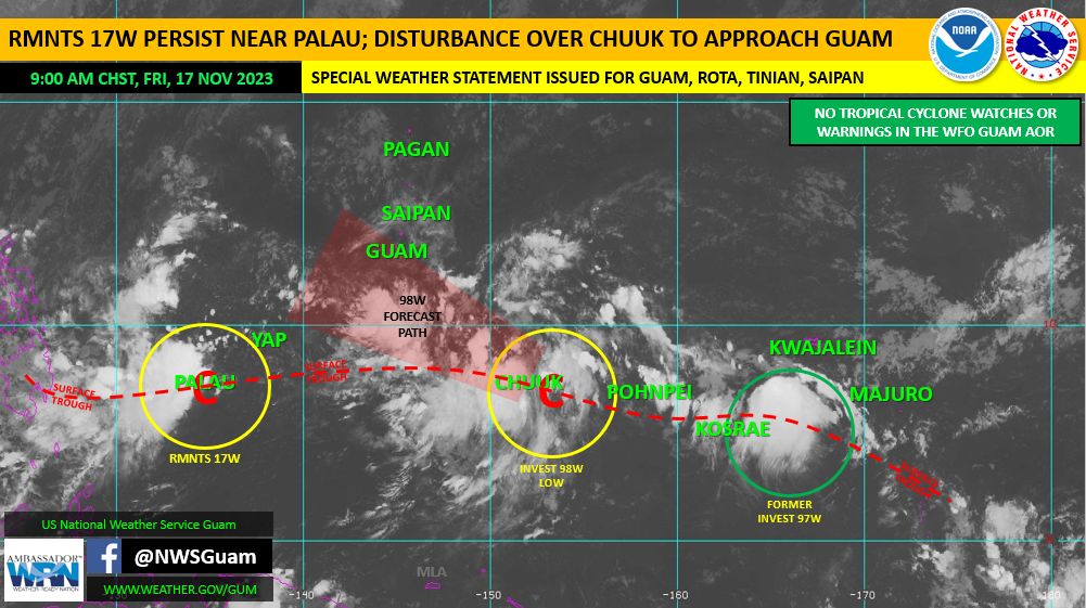
The National Weather Service (NWS) Guam Weather Forecast Office continues to monitor a tropical disturbance, Invest 98W, centered near 7 degrees north latitude and 152 degrees east longitude. Latest model guidance continues to show this circulation developing slowly over the next few days as it approaches the Marianas. It is expected to move through the south of Guam, though this is subject to change as the circulation develops.
What to Expect
There is a possibility this disturbance could become a tropical depression by the time it passes near Guam late Saturday. This disturbance is expected to bring increased showers and thunderstorms to the Marianas, especially Guam and Rota, over the weekend, with wet conditions likely Saturday into Sunday morning.
Current rainfall estimates are for 2 to 4 inches of rain falling between Saturday and late Sunday night. Locally heavy showers could lead to urban and small stream flooding. Flash flooding is also possible Saturday into Sunday. Marine conditions are also expected to become hazardous, with wind gusts as high as 35 knots, and seas of 9 to 11 feet possible during the closest passage to Guam in the Saturday through Sunday timeframe.
Those living in flood-prone areas should take action now; clear drainage areas and unblock storm drains to minimize flooding.
Visit the following links for the latest advisory information:
- NWS Website: https://www.weather.gov/gum/
- NWS Facebook: https://www.facebook.com/NWSGuam/
- GHS/OCD Website: https://ghs.guam.gov/
- GHS/OCD Facebook: https://www.facebook.com/GHSOCD/
For more information, contact GHS/OCD Public Information Officer Jenna G. Blas at (671) 489-2540 or via email at jenna.g.blas@ghs.guam.gov.